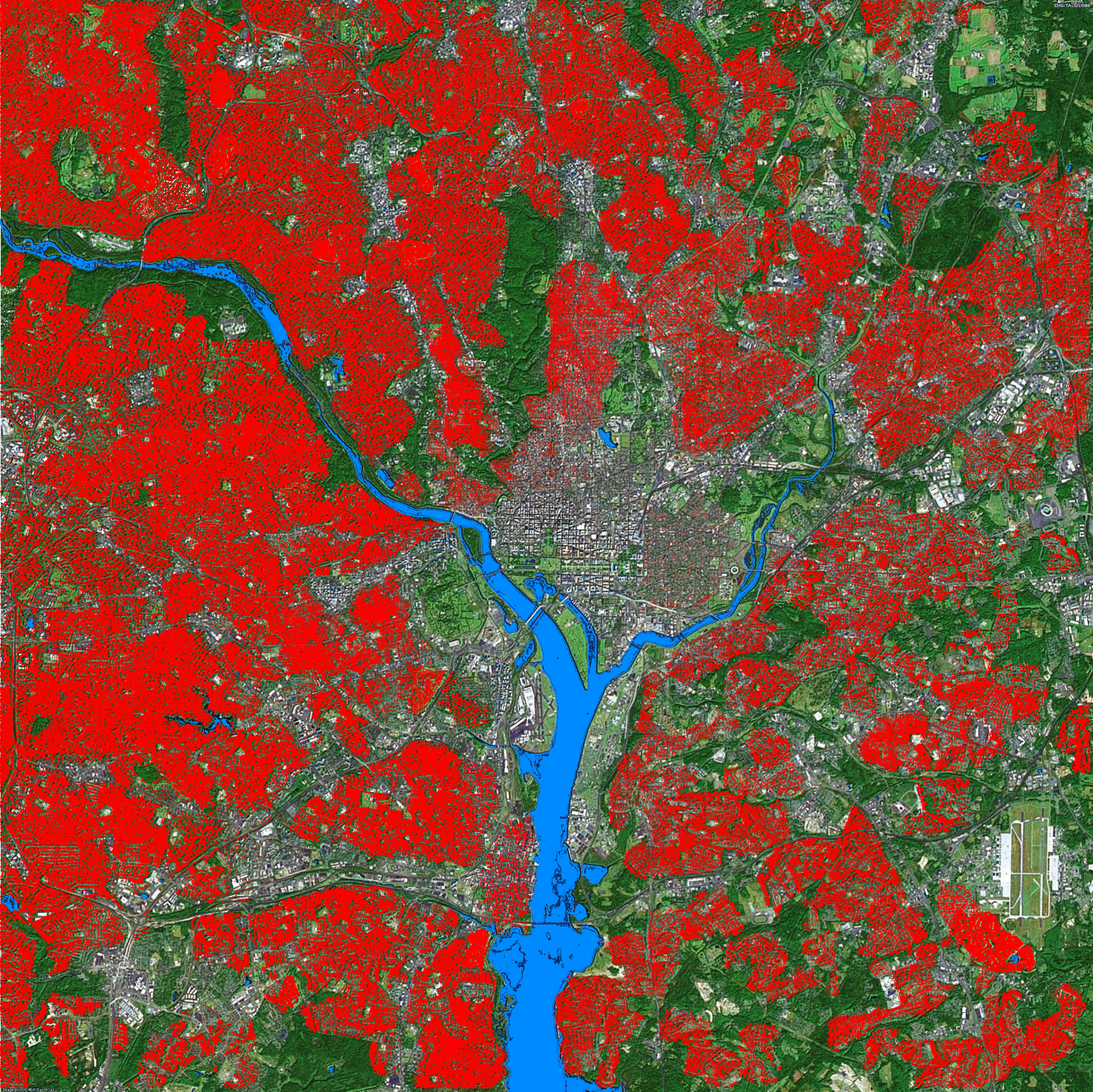
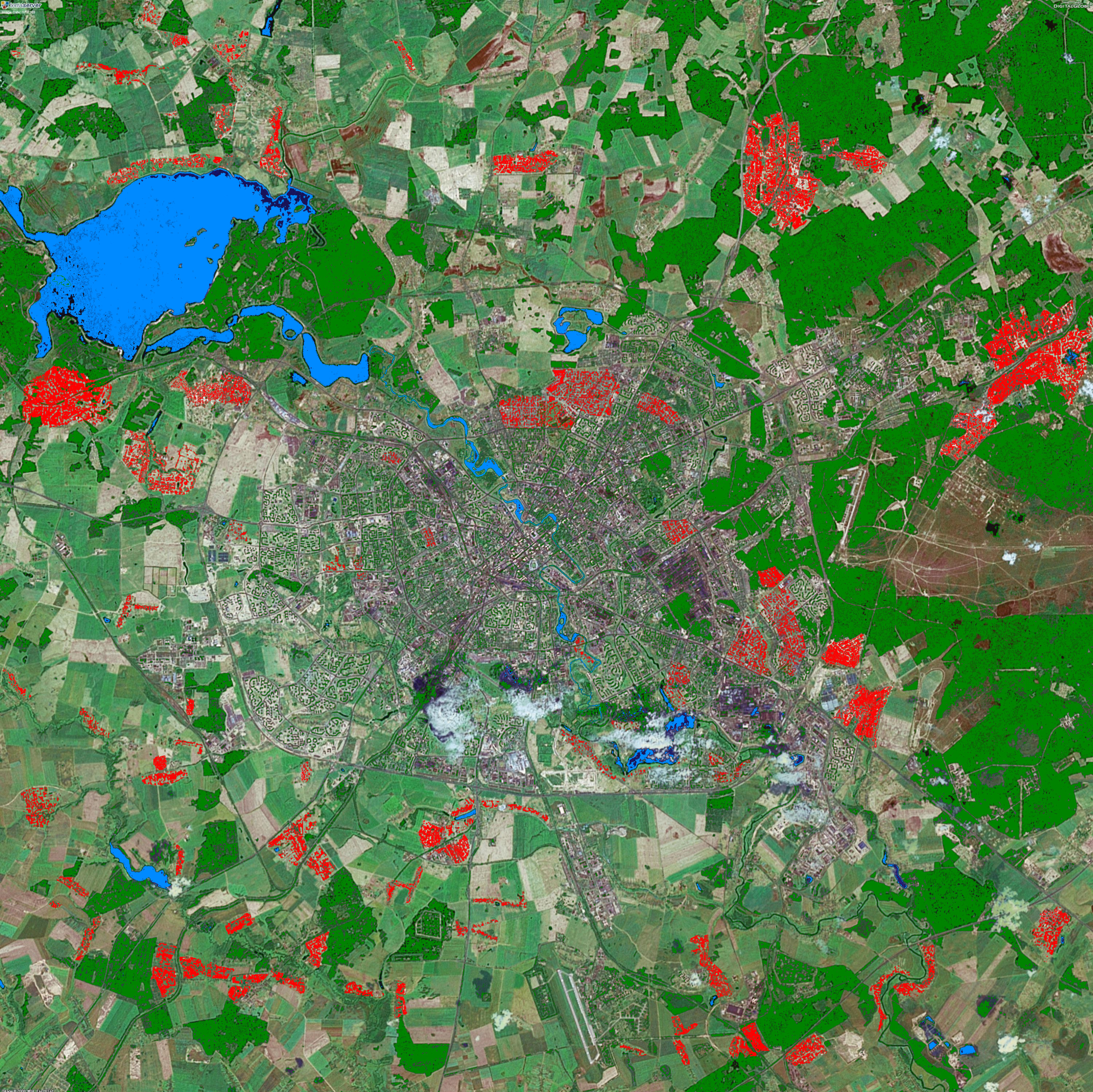
Enhanced satellite imagery graphically demonstrates the difference between Belarusian and American land use. In these images of the capital metropolitan areas, privatized green space is shown in red. The population (2.5 million) and the land area are about the same for both capital areas, but the disparity in land use is striking.
In the DC area, privatized green space consists primarily of yards and golf courses. In Minsk, it's mostly kitchen gardens and some lawn space.
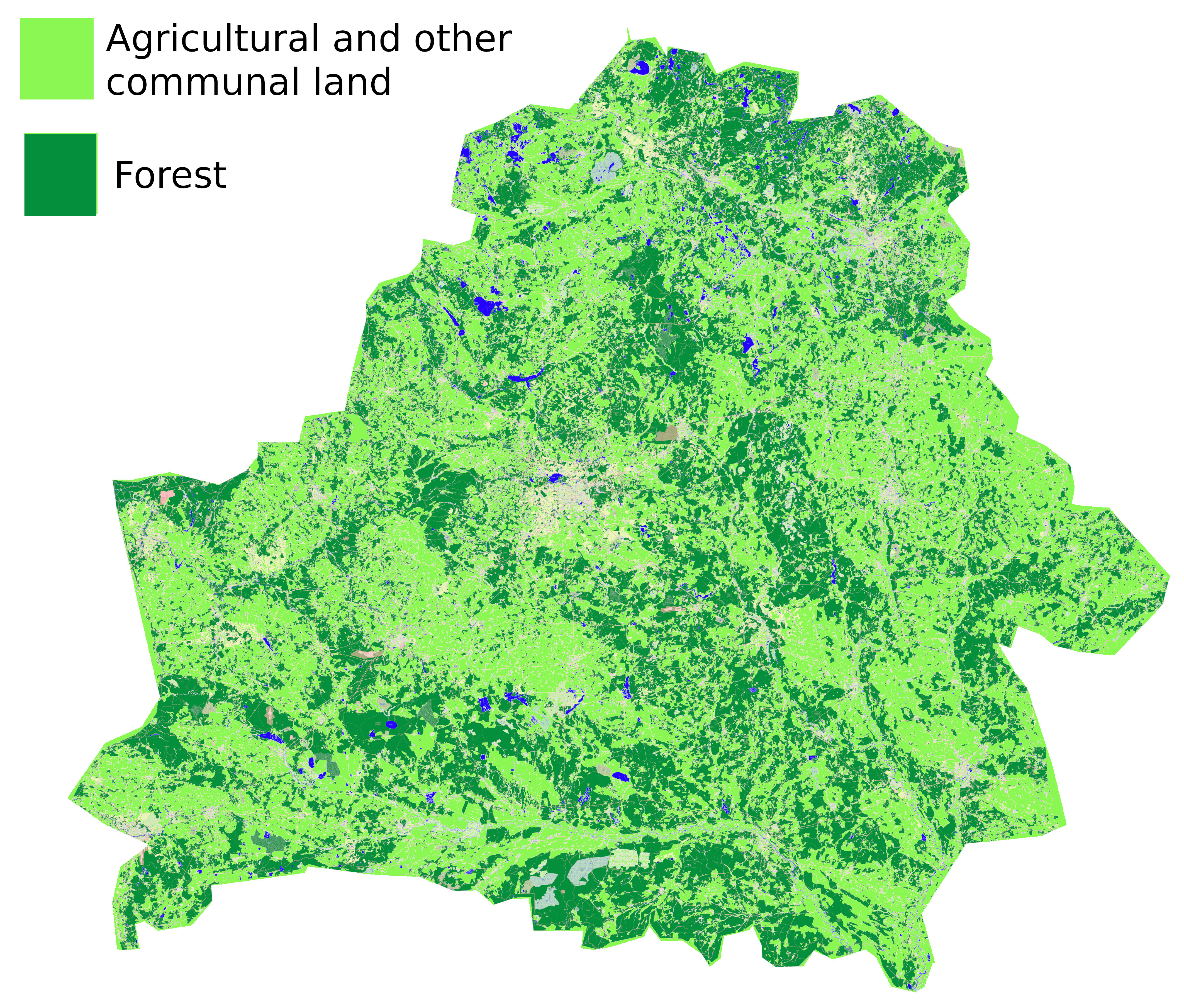
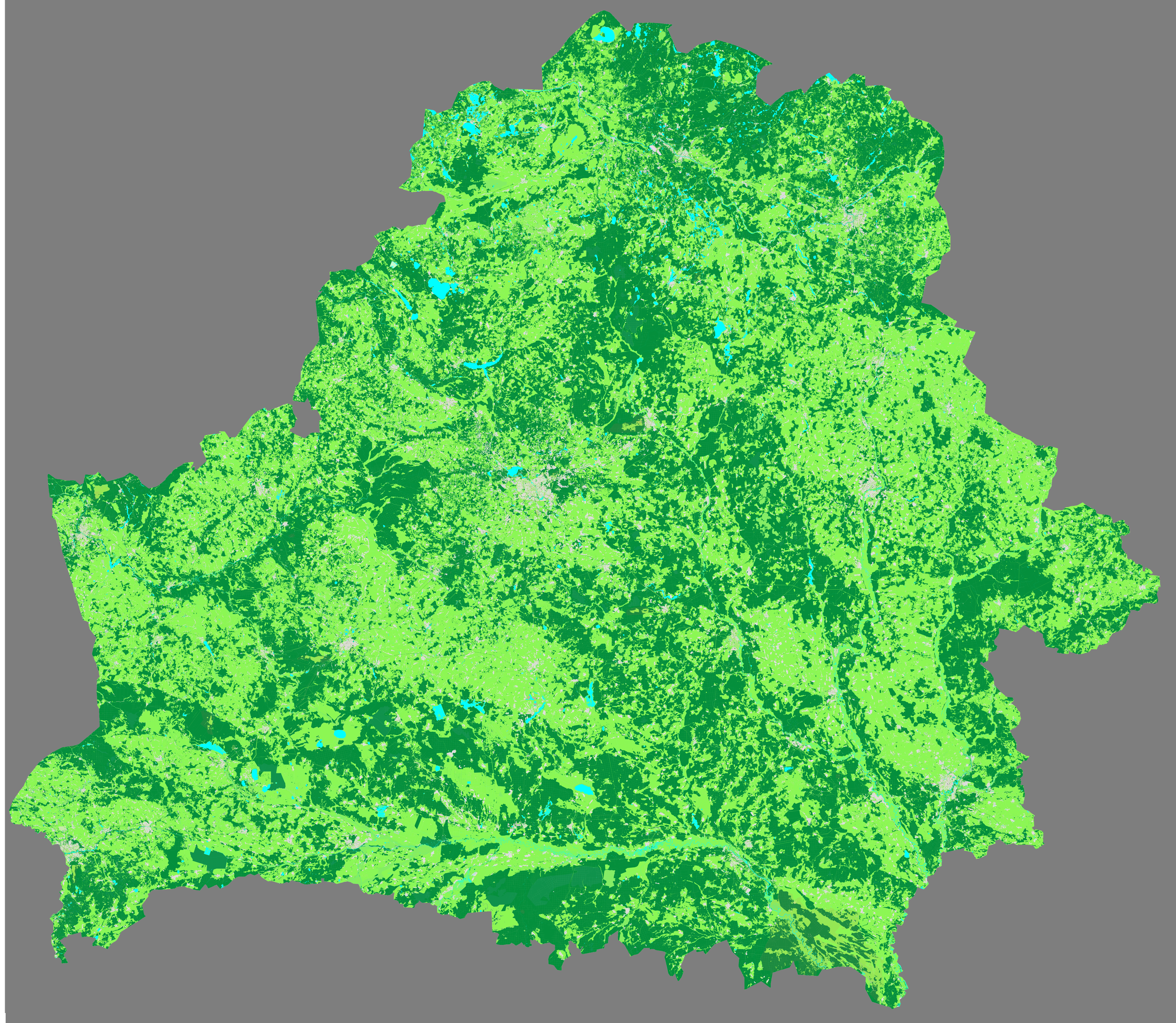
Outside of the Minsk metro region, Belarus is almost entirely covered by open public green space.
Map data copyright (c) OpenStreetMap.
Full-scale land use map of Belarus (38 Mb): belarus-land-use-full.png
Produced using custom tile server: mapnik.xml
Satellite imagery sourced from Microsoft Terraserver.
Color enhancement with GNU Image Manipulation Program.
Image files: minsk.xcf washington.xcf